I gotta admit… I don’t mind June in Southoz.
It’s cold for sure, but at least it’s not downright nasty. There are days of glorious sunshine and light winds, and a steady stream of Indian Ocean cold fronts regularly top up the swell bucket.
It’s pleasing to see that last week’s forecast pretty much went to plan, delivering clean waves well within the predicted windows. South was surprisingly solid on her majesty’s faux birthday, and clean all day with light offshore winds and only a minor Easterly wobble.
We have a couple more days of lovely, light winds, but the billion dollar question is, will there be any swell?
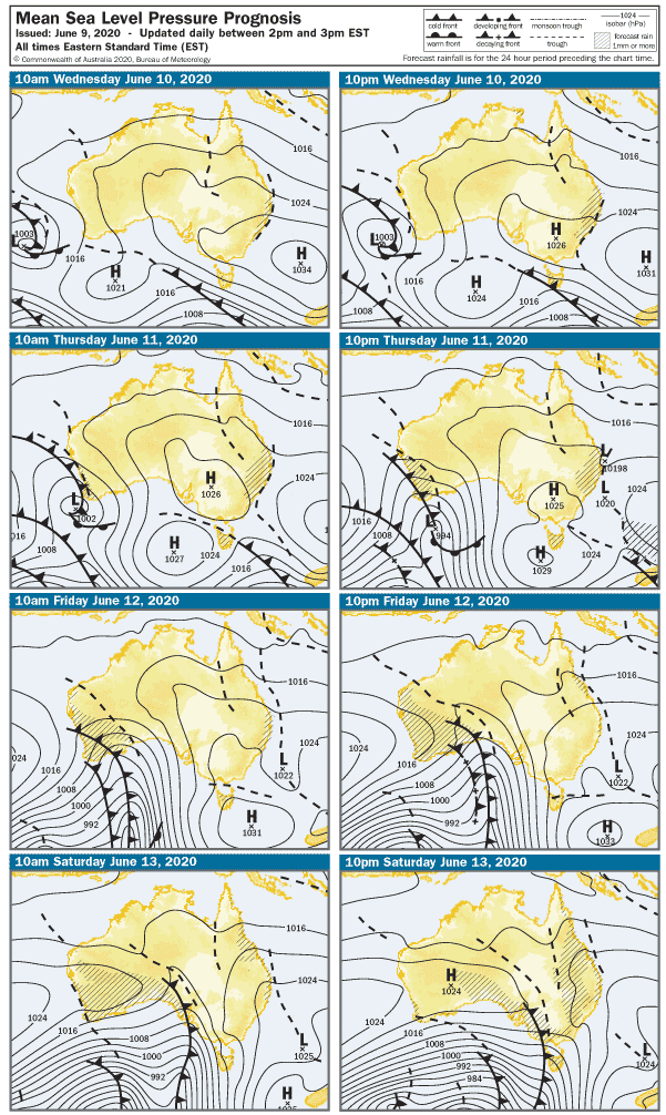
This week’s charts are really interesting from a Metnerd™ perspective. A cold front will slip south of Adelaide on Wednesday, swinging winds NW and then South late in the day. And will you take a look at that complex low and warm front on Thursday! Cool, huh?! In any case, 5 knots is about as strong as the wind will probably get, and a new SW swell will sneak in during the day. West facing breaks over at Yorkes might get it a bit earlier, but even the Mid Coast might see a few 1′ waves by late arvo. The swell will pick up on the South Coast but it’ll start off small with waves around 1 – 2′ at Middleton.
The swell should lift the Mid Coast to 1 – 2′ on Thursday, and it should stay clean with light NE winds tending East at 2 knots after lunch. West facing breaks over at Yorks look fun Thursday arvo. Surf at Middleton should pick up to around 3′, and have similar conditions to the holiday Monday.
The winter Northerlies will return early on Friday, and a 15 – 17 knot offshore breeze will settle in on the South Coast all day. Middleton should hold around 3′ in the morning, but the swell will probably wind down after lunch. The Mid Coast will be bumpy with the Northerlies, but surf should remain in the 1 – 2′ range. Breaks along the South Coast of Sothern YP look pretty good on Friday.
The weekend looks like it’ll open with a fresh Northerly ahead of a gusty Westerly change around 2pm. The Mid Coast will be bumpy with surf around 1′ on Saturday, and Middleton will probably only have surf around 1′. It’s a bit of an in-between day to be honest, so unless you have some sort of sail or kite, forget it.
The late change on Saturday will leave westerly winds behind it, so early on Sunday the Mid Coast will be onshore and messy with 15 knot West winds and 1 – 2′ waves. It’ll be cleaner on the South Coast but Middleton will be small in the morning – probably only 1′. The wind will pick up after lunch and tend more WNW.
The Mid Coast will be near flat on Sunday, and Middleton will only be 1 – 2′ with West winds at 15 knots shifting WNW at 22 knots after lunch. A new WSW swell will lift wave heights along west-facing coasts late on Sunday.
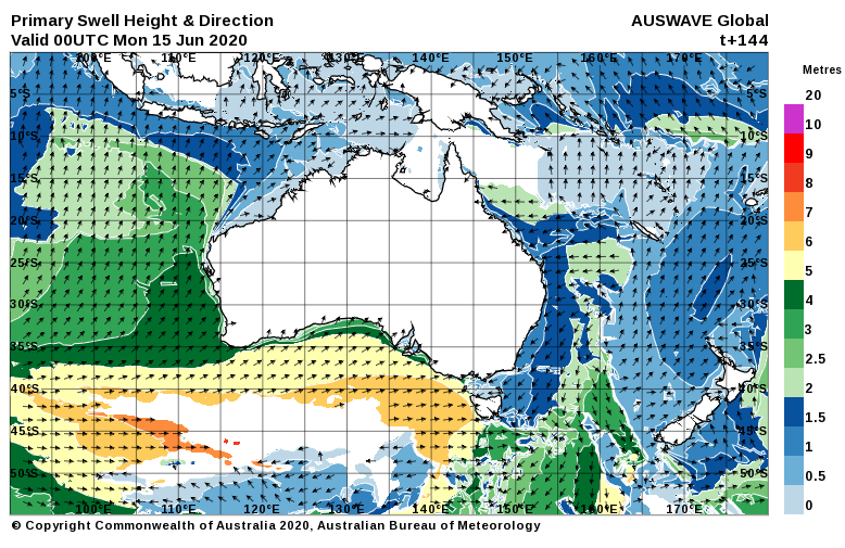
A new WSW swell should arrive for the start of the working week, and it looks like stormy 3′ surf on the Mid Cost on Monday morning. Winds will be onshore from the West at 25 knots. Middleton should pick up to around 2 – 3′ for the start of the week, winds are looking like 25 knots from the West so Middleton Bay may be the go.
The breeze should be more SW by Tuesday, at this stage around 25 knots. The Mid Coast will be onshore and messy at 2′, Middleton should be around 3′ and a bit blown out.
More swell later nest week, but we’ll see how that pans out Monday – Tuesday-ish.