I’m not gonna lie… I expected to see a few small lines hitting the Mid Coast at daybreak today, but 13 hours later I’m typing this and staring at nada surf. It’s not even a foot on the reefs, but there are signs of life on the South Coast this afternoon with a new, well defined SW swell starting to push in. It’s onshore down there, of course…
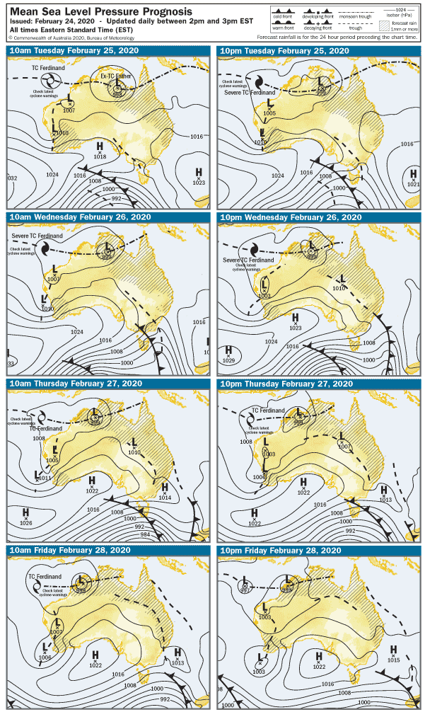
The week ahead looks like another one of mild weather, and it looks like Summer 2020 will go out with a whimper rather than a bang. Swellwise though, it’s looking very interesting with two pretty solid SW swells lining up this week. Also a bonus cyclone off Pt Hedland which will feed in moisture later in the period.
The swell will lift overnight on west-facing coasts and the Mid Coast should be slightly bigger at least, probably around 1′ on the reefs early Tuesday. The breeze looks like it’ll be more Southerly in direction, light early morning but picking up 15 -20 knots after lunch. The South Coast will be onshore, but Middleton should be in the 3 – 4′ range from late morning onward. West facing breaks over at Yorkes will be good for the dawny.
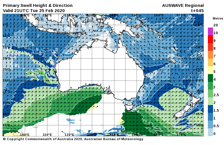
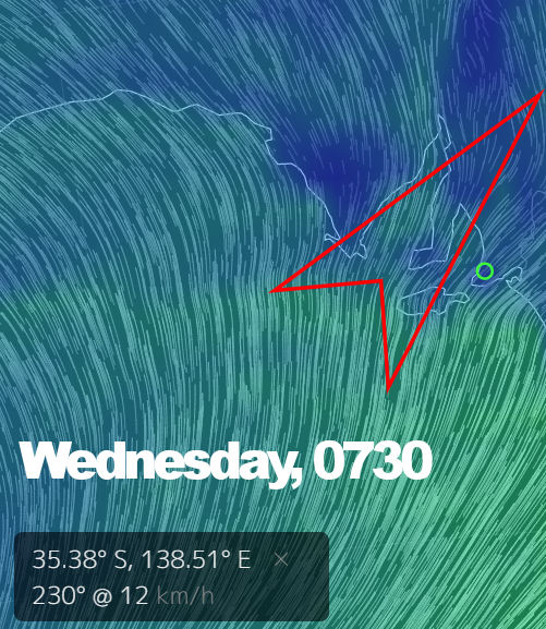
On Wednesday morning the breeze should tend more SW, only 10 knots early but shifting to the South and blowing 15 – 20 knots after lunch. The Mid Coast will remain in the 1′ range and slow with a big tide at 7am, but a new swell will build on the South Coast all day. There may be a window early for some solid waves between Victor and Port Elliot with clean-ish conditions. After lunch should see it pick up to 6′ or so at Middleton, but it’ll be a mess with strong dead-onshore winds.
The swell will peak overnight and ease during the day on Thursday, winds look like they’ll be from the SE and light early. Middleton will be in the 4 – 5′ range in the morning, and with SE winds there are a few spots the other side of Victor that will be worth checking. The wind will pick up from the South after lunch, and trash it everywhere. The Mid Coast will be in the 1′ size range in the morning and clean, then 1′ and bumpy after lunch. Pondie to Berry Bay could be fun early Thursday.
Friday should open to light SE winds and glassy conditions on the Mid Coast, but wave heights will once again struggle to top 1′. Southerly winds won’t get too strong during the day, but it will be enough to take the gloss off a rising swell on the South Coast. Middleton should pick up 4 -5′ by lunchtime, but it could get bigger after lunch. Quality will not be great, again look for that window in the morning and check a few lesser-known spots to the West. Speaking of west, anywhere over at Yorkes pointing that way is looking good early Friday,
Heading into the weekend, the breeze will be more East than South, and there’ll be lingering 1′ waves on the Mid Coast. It’ll be glassy early too, as will west-facing breaks over at Yorkes. The big swell will ease on the South Coast and it’ll be lumpy / glassy 4 – 5′ early Saturday.
Sunday offers the possibility of NE winds on the South Coast, tending ENE early then NE at 10 knots after lunch. It could easily swing SE and trash it, of course. The fading swell should still deliver a few 3′ waves at Middleton, and more size around at Parson’s for the young, fit and intrepid. The Mid Coast will be clean, but waves will be back to around half a foot.
Yorkes ( and the South East! ) looks good from Thursday to Sunday, and a few interesting spots may light up with the big swell. No more clues there… if you can swing it, it could be a bit of fun to see out the end of summer.