A trough crossing the South of the Fleurieu and Yorke Peninsulas this morning turned winds to the SW, but swell remains very small. Yorkes was barely a foot everywhere today, and the same (lack of ) swell will persist into Thursday – until evening.
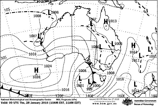
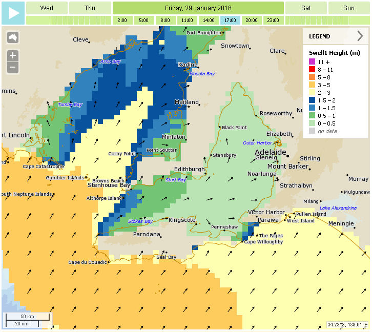
A cold front will lead to stronger SW winds tomorrow and Friday, but of more interest is a new SW swell building through Friday and peaking in the evening. Winds won’t really be good for anywhere though, except may Middleton Bay while the wind has more West in it. Wave sizes should pick up from 2 – 3ft to 4 – 5ft, because the swell has a fair bit of West in it. The Mid Coast will have stormy waves Thursday / Friday with wind tending more Southerly on Saturday ( 15 knots, maybe lighter early ) and finally light and variable on Sunday.
Yorkes and The Mid will still be flat tomorrow but should pick up overnight with new, rising swell Friday morning. Saturday will be bumpy on the Mid but hopefully in the chest-high size range, with a top up from a follow up SW swell.
The Southerlies will trash the South Coast on Saturday but may back off enough early Sunday. Monday is looking a better bet for clean conditions at Victor.
The follow up SW swell will hopefully also still have enough in it for the expected light winds and glassy conditions on the Mid Coast and West facing breaks at Yorkes on Monday.
More on that over the weekend…