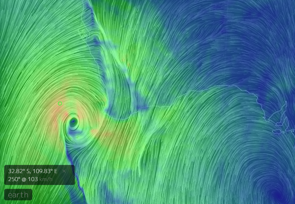
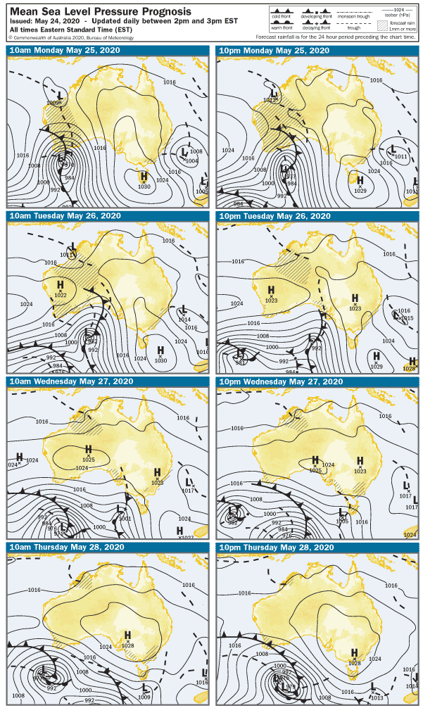
I know it’s not SA, but take a look at this beast that’s about to slam the West this evening. It’s the remains of ex-TC Mangga bumping into old mate Cold Front and Trough, and the three of them kicking off an evening sucking lemons and slamming Tequila shots. Needless to say, there are all sorts of warnings out, and seas will be huge. That wind is gonna do some damage when it slams into SW WA this evening, so let’s hope our COVID-free brothers and sisters stay safe tonight.

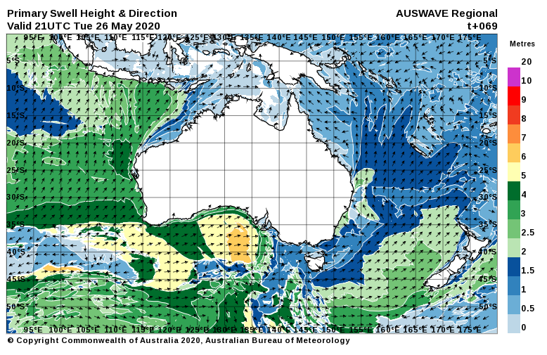
Meanwhile… all is calm in Southoz, but we have a pretty interesting looking week ahead with a particularly good looking westerly swell on the way.
Light South winds have all but dropped out over the Fleurieu and Yorke peninsulas this evening, and early on Monday morning the breeze will be just a puff from the East. The Mid Coast will continue its recent lameness and waves will struggle to top shin high. It’ll be glass early at least. The easing swell will leave waves around 2 – 3′ at Middleton, and the light East winds may add some lumps. And more brown crap.

A light Northerly will kick off Tuesday morning and conditions will be nice and clean on the South Coast. The swell will be smaller though, and Middleton is looking around 1 – 2′ all day. Wave heights on the Mid Coast will lift to 1′ or so, but the North wind will add lumps.

Which brings us to Wednesday…
A WNW wind around 12 knots will add a few bumps on the Mid Coast and over at Yorkes, but west-facing breaks will get their first whiff of a brand new swell. It’s about as westerly as it gets, so there’ll be some solid waves later in the day along exposed, sunset-facing coastline. The Mid Coast will kick off around 2′ and may have a few lumps, but the wind will drop to nothing by mid arvo. Better still, the incoming tide will bring a building swell with it, and 3′ sets look possible. The tide will be a bit full after 4pm, but there should be waves everywhere. The swell will mostly miss the South Coast, and it may even be one of those crazy days when the Mid is actually bigger. West facing breaks over at Yorkes mid arvo FTW.
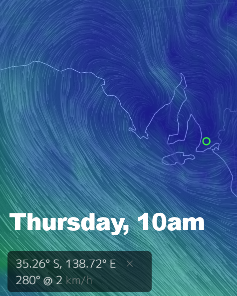
Thursday looks damn good as well. There will be bugger all wind all day ( if the models remain true for the next 4 days, reasonable chance with a large HIGH moving across SA ) and the Mid Coast will have clean 2′ waves. West facing breaks over at Yorkes will be excellent all day, and at least some of the swell should wrap in along the South Coast. Middleton may get up around 3 – 4′ later, and it’ll probably be glassy all day.

We’ll go back to a Northerly on Friday morning as another front approaches SA. the Mid Coast will remain in the 2′ range, but it’ll be bumpy with 15 knot winds blowing down the gulf. The South Coast will be clean, and surf may be in the 3 – 4′ range at Middleton despite a less-than-perfect swell direction.
The weekend looks like it’ll coincide with a cold front and WNW winds on Saturday at 20 knots or more. The Mid Coast will maintain 2′ waves but quality doesn’t look great, the South Coast should be clean but possibly blown out along exposed stretches. It’s a bit hard to call after Sunday, but I’ll slip an updated forecast in later this week to cover that.
For now, get amongst it – the water ain’t too cold yet and there’ll be plenty of opportunities across the state this week