It’s been a pretty unusual November so far, with an almost Autumn like dominant weather pattern and more days of Westerly winds than the usual howling sou-easters. But weirder still there has been swell… the South Coast was in the six foot range Friday / Saturday and even the Mid Coast scored a few waves over the weekend. Yorkes had a pretty good week too, with clean conditions and swell favouring west facing breaks over the weekend.
A large High pressure system is drifting over SA from the west, and temperatures will soar over the next couple of days. Tonight it’s dead glassy with no wind over the Fleurieu Peninsula, and the wind will still be very light early on Tuesday.
Unfortunately, Tuesday is an in-between day, and the Mid Coast will be clean but surf will only be around 1ft and full in the morning with the big tide at 0730. The fading swell won’t leave much on the South Coast either, Middleton will be around 1′ so Parson’s will be your best bet with a bit of East in the wind expected.
Wednesday is shaping up to be hot and windy, and a catastrophic day in terms of bushfire risk with an estimated maximum over 40°C. Surf will be small early at around 1′ on all sides of the Fleurieu, and blown out later by 30 knot NW winds if the forecast is on the money.
A front will roll through overnight and Thursday will dawn to fresh onshore SW winds in the 27 knot range. The Mid Coast should build to a messy 2′ after lunch, with the wind easing and tending more Southerly by late arvo. Middleton will only be around 1′ in the morning, but should kick to 2 – 3′ by mid arvo. Conditions will be messy with strong onshore winds.
Friday should see light Southerly winds early, possibly even tending light SE under 5 knots. The Mid Coast should have some 2′ waves, maybe even the odd bigger set early with a bit of leftover wobble in the swell. Middleton should be around 3′ and possibly glassy in the morning, before the onshores pick up again. West facing breaks over at Yorkes could be good early on Friday and into Saturday.
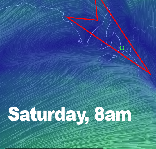
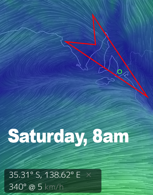
The wind is looking light all day on Saturday, tending NW at 2 knots early then WNW at 5 – 7 knots after lunch. It’s possible both the Fleurieu and Yorke Peninsulas will be glassy for the better part of the day. Not only that, but West and South facing coasts will score swell, with 2′ waves likely on the Mid Coast and clean 4′ waves at Middleton. The whole of Innes NP ( and beyond ) over at Yorkes should be firing on Saturday.
Sunday will probably see winds tend W-SW and pick up with the passage of another cold front, but the Mid Coast should remain in the 2′ range. The wind may be lighter and Westerly early on the South Coast, and with Middleton around 4′ it could be worth a drive early.
Next week is a bit hard to call at this stage, but hopefully it’ll be more of the same.