SA surf outlook Feb 15 – Feb 19 2016

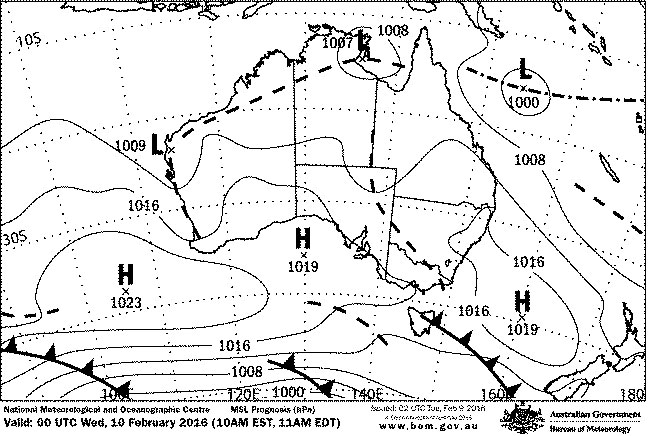
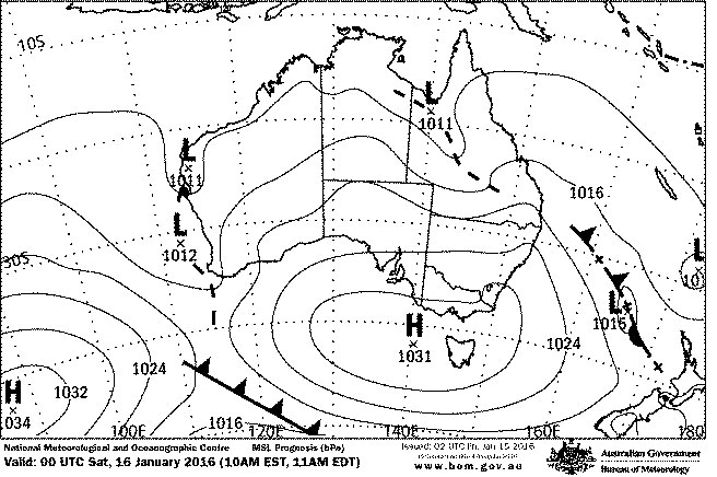
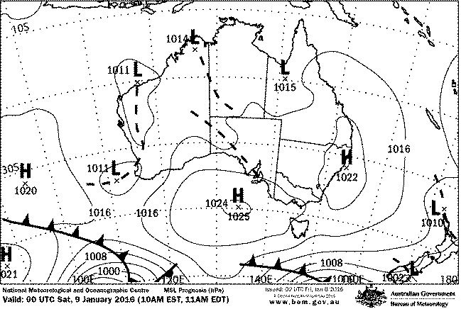
After a rare summer weekend of light WNW winds, onshores have returned to the South Coast… and look like cursing the rest of the week. On the upside, a new WSW swell and light SE winds delivered some fun waves on the Mid Coast early Monday.

feb20_wind

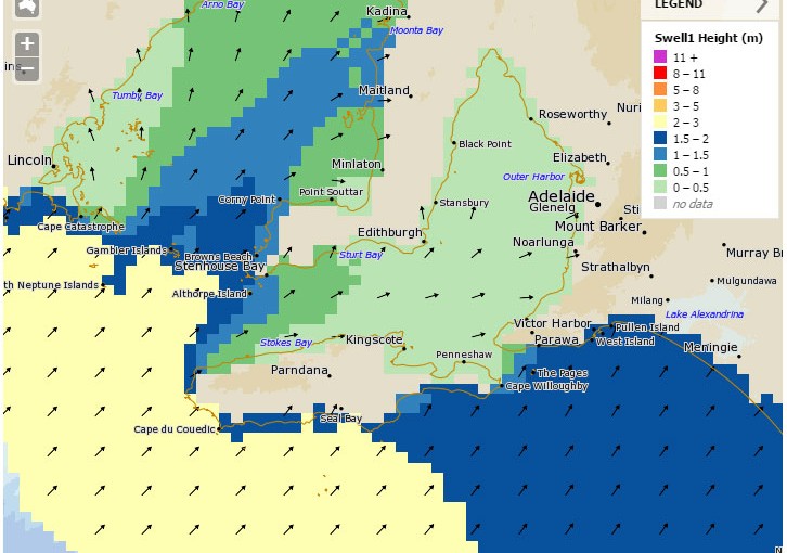
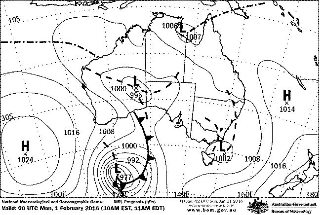
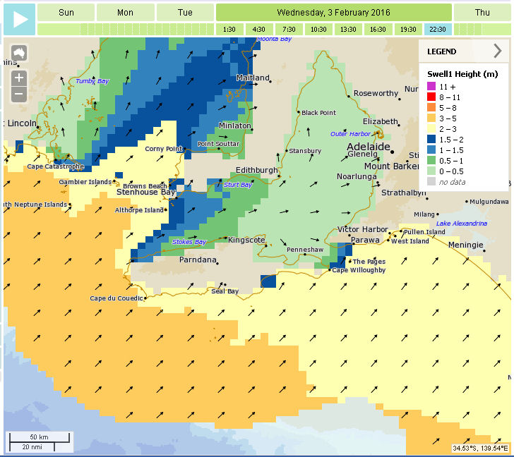
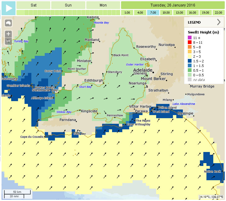
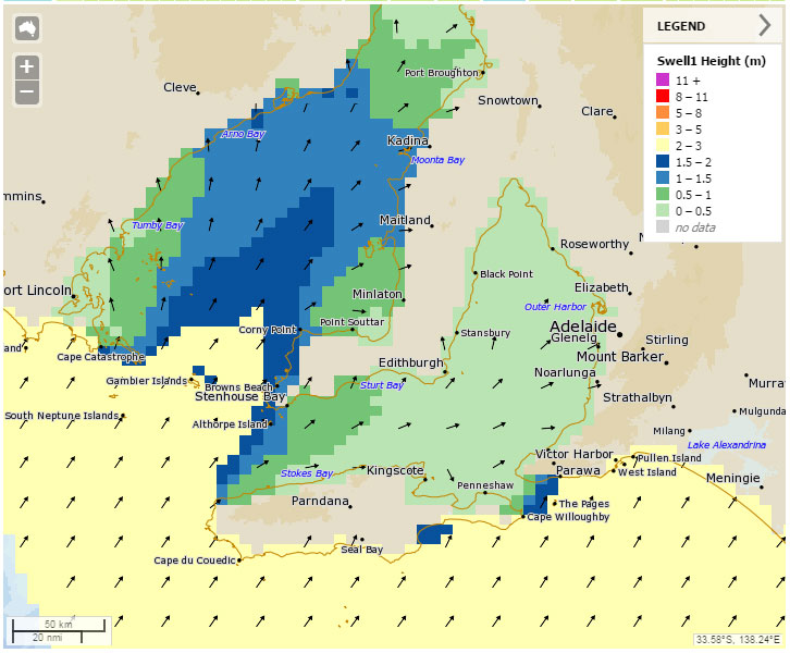
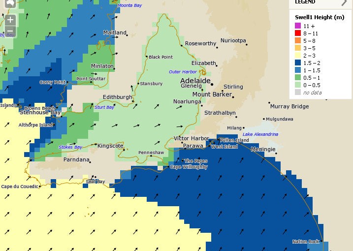
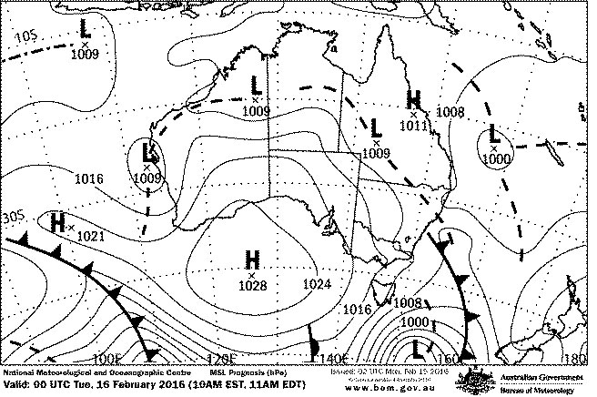
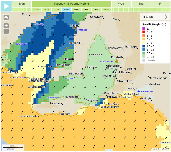
Overnight winds will shift more Southerly and will probably have a fair bit of South in them at around 10 -15 knots early Tuesday. There should be a few 1 – 2′ waves on the Mid if you don’t mind a bit of a bump. Of some interest is a rising SW swell ( 3 – 5m ) early Tuesday. While most of the South Coast will be onshore slops, a few sneaky spots the other side of Victor might get a guernsey after lunch if the wind is SE.  This SW swell will ease and tend more WSW into Wednesday, but another pulse from about the same direction will set up a similar scenario on Thursday.

synoptic_15feb+24

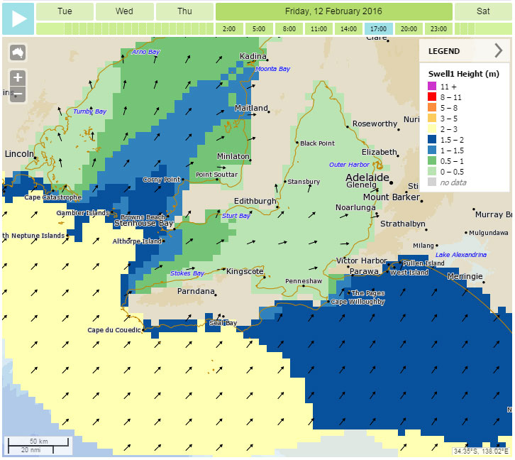
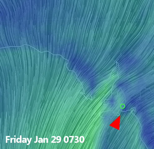
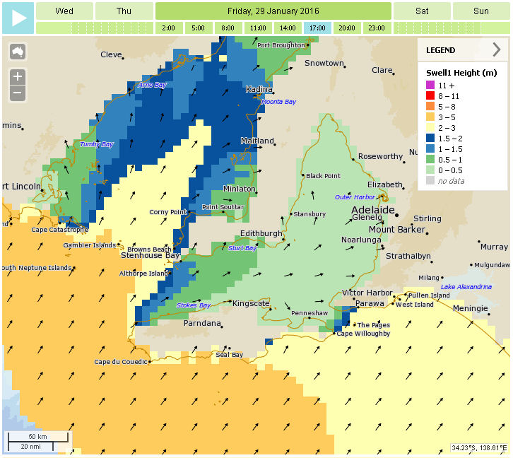
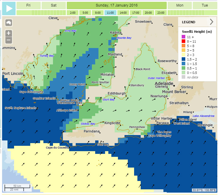
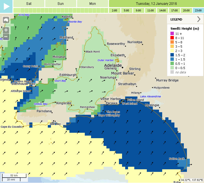
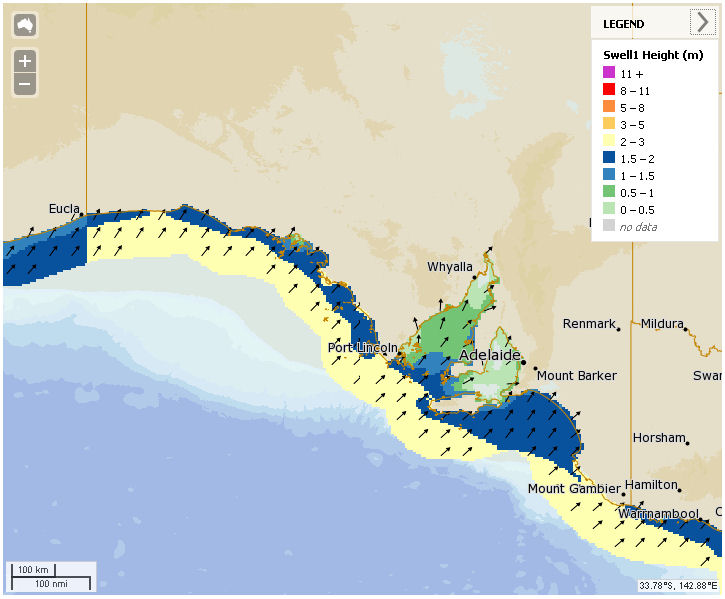
West facing breaks at Yorkes   will have a reasonable week with something surfable ( 2 – 4′ ) almost every day, and ESE winds Wednesday and Friday. The Mid Coast will also have small waves ( 1 – 1.5′ ) almost every day this week, swell will be a bit bigger on Tuesday but winds will be better on Wednesday.  Friday may get a  small top-up in swell. The South Coast east of Waits and Parson’s will be messy for most of the week and in the 3 – 5′ range, with S-SE winds between 10 and 20 knots dominating.

feb16_swell

Onshores looks like persisting on the South Coast into next weekend, and a small SW swell will ease from about 1′ on the Mid Coast. Things of course, may all change later in the week. Watch this space for updates!

0

SA surf outlook Feb 9 – Feb 13 2016

A classic  summer weather pattern dominates SA at the moment courtesy of a large blocking high over the Bight. SE winds have settled in for the week, and will be with us until later on Friday when a  weak  change will start to move in.

synoptic_9feb+24

A small WSW swell is building on the Mid Coast and winds should swing back to the SE early Wednesday morning. Thursday will be similar with 1 – 1.5′ waves on the reefs becoming bumpy later with afternoon sea breezes.  The South Coast will remain onshore and lumpy for the rest of the week, but there’s a window early on Saturday.

feb13_wind

It looks like winds will go light and variable late Friday, and a SW swell ( with a combo WSW swell ) will top up Thursday’s fading swell on the Mid, but also lift the South Coast to around 3 – 4′.  Early Saturday ( or possibly friday evening ) is your best shot for waves at Victor, with light WNW winds swinging W-SW and then onshore Southerly during the day.

feb12_swell

There’s also a chance of an Early on the Mid Coast Saturday, Sunday’s a bit sketchy at this stage. More on that heading into the weekend…

0

SA surf outlook Jan 31 – Feb 4 2016

A small WSW swell and light East winds have let a  few clean waves sneak in on the Mid Coast the last two days, and light variable winds produced reasonable conditions on the South Coast this morning.

synoptic_feb1

Some of that swell will linger into Monday and winds will again be light, tending East on the Mid and West facing coast over at Yorkes. Surf will probably continue around 1′ on the Mid Coast, and 2′ at spots like Lizards over at Yorkes. On Tuesday a low will pass over Adelaide, with fresh East winds early shifting North, NW, then SW by lunchtime.

winds_feb2

A small stormy will probably pop up on the Mid during the arvo and it should build into Tuesday,  conditions may be OK down South as the wind tends more NW – W later on. Surf should be in the 2 – 3′ range at Middleton, but by mid arvo it’ll be pretty windy everywhere.  SW winds will dominate through Wednesday, but they should ease overnight and start to swing offshore early on thursday.  Some remaining WSW swell should produce some OK waves on the Mid and over at Yorkes during the day.

wam_feb3

At this  stage it looks like SE winds will tend more E – NE heading into next weekend,  and a more SW-S swell will arrive toward the end of the week. The Mid Coast and west facing breaks at Yorkes will fade into Friday, but the South Coast may be OK for an early on Friday and Saturday.

0

SA surf outlook Jan 27 – 30 2016

A trough crossing the South of the Fleurieu and Yorke Peninsulas this morning turned winds to the SW, but swell remains very small. Yorkes was barely a foot everywhere today, and the same (lack of ) swell will persist into Thursday – until evening.

synoptic_jan28

A cold front will lead to stronger SW winds tomorrow and Friday, but of more interest is a new SW swell building through Friday and peaking in the evening. Winds won’t really be good for anywhere though, except may Middleton Bay while the wind has more West in it. Wave sizes should pick up from 2 – 3ft to 4 – 5ft, because the swell has a fair bit of West in it. The Mid Coast will have stormy waves Thursday / Friday with wind tending more Southerly on Saturday ( 15 knots, maybe lighter early ) and finally light and variable on Sunday.

winds_jan29

Yorkes and The Mid will still be flat tomorrow but should pick up overnight with new, rising  swell Friday morning. Saturday will be bumpy on the Mid but hopefully in the chest-high size range,  with a top up from a  follow up SW swell.

wam_jan29

The Southerlies will trash the South Coast on Saturday but may back off enough early Sunday. Monday is looking a better bet for clean conditions at Victor.

The follow up SW swell will hopefully also still have enough in it for the expected light winds and glassy conditions on the Mid Coast and West facing breaks at Yorkes on Monday.

More on that over the weekend…

0

SA surf outlook Jan 23 – 27 2016

After flirting with offshores amidst  Friday’s thunderstorms and insane rain, we’re back to the dreaded summer sou-easters… and they’re here to stay.

synoptic_jan23

Two large Highs over the bight and Indian Ocean will maintain a SE-E airstream over the next few days, but winds look like they will go light and variable through the middle of Wednesday. The favourable winds for the Mid Coast won’t be backed up by any swell, and it’ll be lucky if it tops shin-high over the next 4 days. A slight increase in SW swell on Australia Day should lift the South Coast to 3 – 4ft  and breaks at the foot of Yorke Peninsula should also pick up by a foot or so. The 1 – 2m SW swell will ease again into Thursday.

winds_jan27

SE winds between 10 and 20 knots will dominate the next few days, Parson’s Point may be OK in the mornings with lighter winds tending E-SE. West facing breaks at Yorkes look like they’ll range 1 – 3ft.

wam_jan27

Later in the week looks like finally delivering a new WSW swell with favourable winds heading into the last weekend of January. It could all go pear-shaped between now and then of course, such is fickle summer weather.  More on that early in the week!

0

SA surf outlook Jan 19 – 22 2016

*Update – Jan 20

The crazy summer weather has freaked out the forecast models a bit this week, and the South Coast will start to go onshore earlier than expected. Winds will be light early Friday so there’s still a window with the new swell building overnight on Thursday. Swell direction is not perfect for the Mid but some of it should sneak in, just nothing like last Friday. Winds will be good, tides won’t be so good and rule out several breaks at otherwise favourable times during the day. The next few days, and possibly into the weekend, are still looking good for West facing breaks at Yorkes.

jan20_wind
updated wind model

Jan 19

The South Coast has been in a light Northerly airstream over the last couple of days, so there has been glassy conditions in the mornings. Today marks the end of that run as a trough moves across the state. Winds will go onshore later today and back to the  dreaded SE overnight, tending more Easterly on Wednesday and Thursday.

synoptic_19jan+24

Swell direction is not great for the Mid Coast all week,  there’s a small refracted swell getting in today that will probably produce similar half a foot waves over the next 2 days. Conditions will be nice and clean with East winds. Friday will see a new SW swell kick in, and some refracted swell may lift the Mid to a foot or so, but nothing like last Friday. NW winds will probably make it bumpy anyway.

jan19_wind

The South Coast on the other hand looks pretty good on Friday, with a 3m SW swell and light offshore N-NW winds for the first half of the day.  The Middleton – Goolwa stretch should hopefully get back up around the 4′ mark and clean, Waits and Parson’s will be bigger and pretty solid.

jan20_swell

Yorkes will be a bit of a mixed bag over the next couple of days, winds will favour West facing coast up until Friday with surf between 1 and 3 feet. Friday will favour spots that prefer a bit of North in the wind, and like a good SW swell.  You can join the dots on that one!

More on Friday.


0

SA surf outlook Jan 15 – 18 2016

The Mid Coast turned it on for the first time in 2016, with offshore East winds and good chest high waves almost everywhere this morning. Winds will remain favourable for the Mid heading into and through the weekend, but the swell will decrease over the next 24 hours.

synoptic_15jan+24

The weather will be great over the weekend and tend light Easterly on Sunday – but it’s not quite  gonna go offshore on the South Coast. Probably the best you can hope for is an early at Parson’s or Goolwa on Sunday, with a possible whiff of NE in the wind. Mostly the south coast will be plagued by the summer E-SE lumpiness.

jan16_wind

Of note is a new SSW swell that will start to lift size on the South Coast during Sunday. A few lesser known spots favouring that swell and wind  direction could be well worth driving a few extra kays for.

jan17_swell

The same swell may produce a small lift in refracted swell on the Mid Coast, and the South Coast should be a bit bigger on Monday morning than Sunday morning. Yorkes is looking good all weekend with waves ranging 2 – 4′ along the western facing coastline, and offshore SE-NE winds light on Sunday morning.

Winds look like gradually turning more NE and finally to the North and offshore down South around Wednesday 20th. More on that next week.

0

SA surf outlook Jan 9 – 13 2016

Tomorrow looks like the first day of offshore conditions on the South Coast, and you better grab it while you can. A large slow moving high will maintain the hot weather ( high 30’s on Sunday ) and light ENE winds will slowly tend more NE-N over the Fleurieu and Yorke Peninsulas.

synoptic_jan9

A new SW swell will also lift wave sizes during the day down South, possibly over 4ft along the Middleton – Goolwa stretch. The Mid Coast will only see small refracted swell, nothing much over shin-high all day. A SW change will roll through early Monday morning but winds will quickly ease and move back to the S-SE. In any case the South Coast will then remain onshore and sloppy at least up until the middle of the week.

sunday_1030

If you’re thinking Yorkes, Sunday or Tuesday / Wednesday will be good with a new SW swell and SE winds favouring breaks on the West-facing side of the peninsula.

wam_jan12

The Mid Coast may see a small lift from a refracted swell on Wednesday, winds will be good but it’s unlikely to top one foot.

The weather looks to be heating up again during the week, and winds may be swinging more North heading into next weekend. More on that later in the week.

0

SA surf outlook Jan 4 – 8 2016

The run of swell we enjoyed over the new year’s period fizzled out into the start of 2016, but there’s some hope later this week.

A large high beneath the SA/WA border is drifting slowly east, which means hot weather and winds trending SE initially, but later swinging to the North.

synoptic_jan5

The bad news is that “later” means the weekend ( most likely Sunday ), and that means a few more days of onshore SE-S winds on the South Coast.

You’ll fair better if you’re headed to Yorkes, with a SW swell in the 1 – 2m range and SE-E winds over the next few days. The swell and wind direction will favour breaks on the Western side of the peninsula.

wam_jan5_fri

The Mid Coast will lift a bit on Tuesday but probably won’t top a foot due to a refracted SW swell. The swell should have a bit more West in it Friday, which may lift size a tad. Winds will be SE, and light in the mornings for the next few days.

0

Mid and South Coast, Yorkes surf outlook

Dec 30 – Jan 3

Hot weather and rising temperatures over the next couple of days will preceed a weak cool change on New year’s eve. Light North winds today and Thursday 31st will favour the South Coast, but the small WSW swell on the Mid Coast should continue to deliver 1ft Mally waves and a small lift in size on Thursday. The change will deliver onshore Southerlies down South on New Year’s day so it’ll be bumpy from early on and remain that way with sou-easters persisting right through the first weekend of 2016.

synoptic_dec30

Winds will be better for the Mid Coast in the mornings over the weekend, swell direction will be good for the first 2 days of 2016 with waves around a foot on Friday and maybe a smidge bigger on Saturday.

If you’re headed to Yorkes, probably the next couple of days are your best shot, although New Year’s Day and the weekend will still be OK – just with less options. There will probably be small waves at Pondie over the period, but the S-SE winds will not be too flash for anywhere else with the fading swell heading into next week.

0