Well, here we are on winter’s doostep so I guess it’s no surprise it feels sorta… wintry? This weather will take a couple of days to blow through, but later this week we should be back to finer conditions and light winds.
Last week’s forecast panned out pretty well with a few good days on the South Coast and the predicted WSW lighting un the reefs breaks on the Mid Coast and over at Yorkes Wednesday / Thursday. The wind was a bit of a dud though, tending more NW and stronger than expected at the height of the swell. To those who picked the little windows of opportunity and didn’t have to be somewhere else significantly less fun when they arose, bravo.
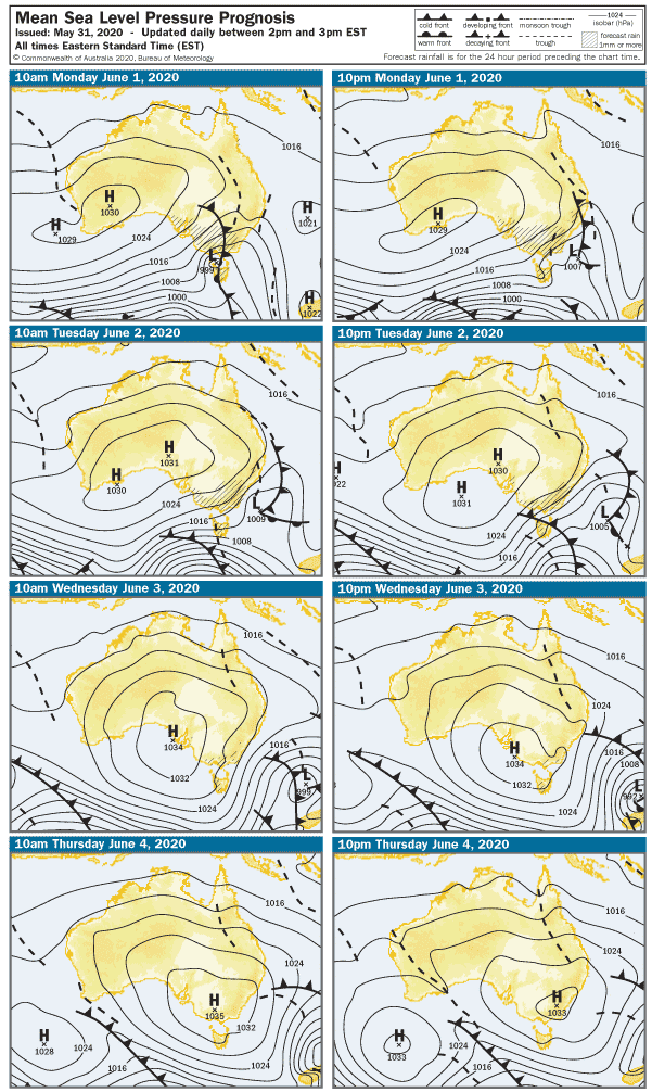
Winter 2020 will open with gusty WSW winds and rain, and stormy conditions in the Gulf of St. Vincent. The Mid Coast will be 3 – 4′ on Monday but most of the usual suspects will be off-limits. Part sheltered spots will be the go and yes, that probably includes Adelaide’s worst kept secret spot. Take a ticket, and wait patiently. The less-than-ideal swell direction for the South Coast will leave Middleton around 2′, maybe 3′ along the Day St. stretch with strong cross-onshore winds. It probably won’t be big enough for sheltered spots.
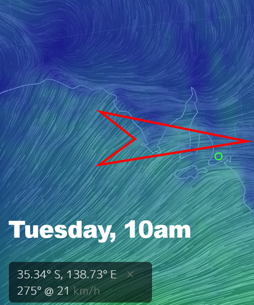
The wind will ease and stay out of the West early Tuesday, leaving wind effected 2 – 3′ waves on the Mid Coast. The South Coast could be OK early – mid morning, and there’s even a slim chance of a bit of North in the wind at 17 knots. Middleton is looking in the 3′ range so the Bay is a reasonably good chance for clean-ish waves.
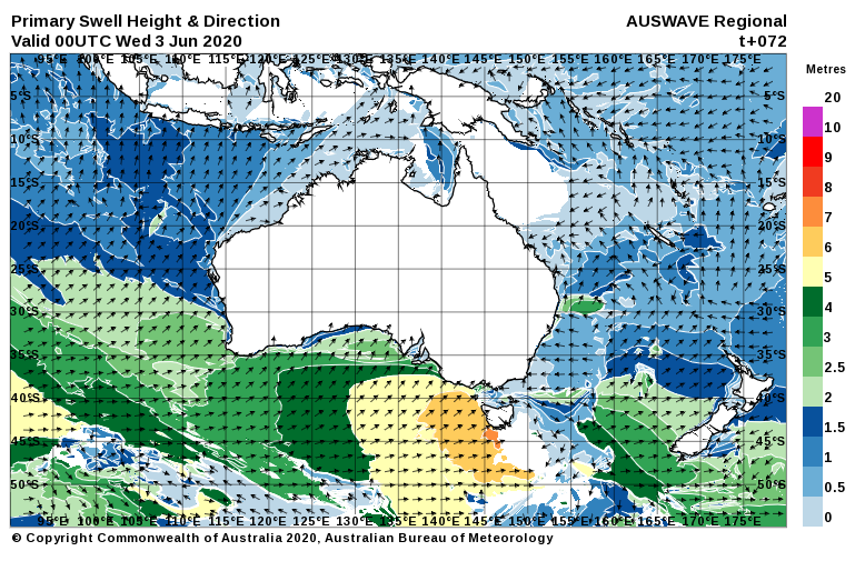
Late Tuesday’s SW wind will swing dead onshore overnight, and early on Wednesday a 10 knot Southerly will create messy conditions on the South Coast. It’s a shame, because a new SW swell will fill in during the day, and the Middleton – Goolwa stretch may get back up around 6′ after lunch. The wind will be rubbish for sheltered spots, unfortunately. Meanwhile, west-facing breaks will start to improve as winds tend more offshore from the SE at 10 knots later in the day. The Mid Coast should have some 2′ waves on the incoming tide, and it is looking cleaner after lunch at this stage. West facing breaks over at Yorkes also look good after lunch on Wednesday.
As a large HIGH moves over Adelaide winds will become very light early on Thursday, with a light land breeze and glassy conditions on the Mid Coast. Surf should still remain in the 1 – 2′ range, after lunch the incoming tide may give it a push mid arvo. The large fading swell will leave solid waves on the South Coast early Thursday, probably glassy at dawn but lumpy from the onshores the day before. West facing breaks over at Yorkes look pretty good Wednesday – Thursday.
The wind will tend more Northerly toward the end of the week and heading into the weekend. Friday will kick off with a light Nor-wester, picking up 10 – 15 knots mid-morning – possibly dropping out again after lunch. The breeze will gove the Mid Coast the wobbles but some lingering swell should leave a few 1 – 2′ waves behind. The smaller swell will leave Middleton around 1 – 2′, but it’s looking clean as a whistle all day. The swell will stick around over at Yorkes, the early might be OK.
The weather is lining up very much like the weekend before, with a front moving into SA for the start of the long weekend. Saturday is looking like a freshening NW wind ahead of a gusty WSW change later in the day. Sunday looks stormy with strong onshore WSW winds, similar to Monday. The Mid Coast will be wind affected and surf will be in the 1’+ range, and surf will probably be small and blown out on the South Coast.
I’ll sneak in a new forecast before the long weekend, so hopefully there’s some good news there.