It’s been a weird November.
I mean weird all over the country… with bushfires threatening places they have no right to threaten in NSW at any time of year, and a nervous afternoon for the CFS with major outbreaks on the Eyre and Yorke Peninsulas.
As I type, a SW change has reversed the front of a pretty scary fire close to Port Lincoln, and the weather is cooling down over SA. That will set the tone for the next few days, as winds tend uncharacteristically westerly for the entire week.
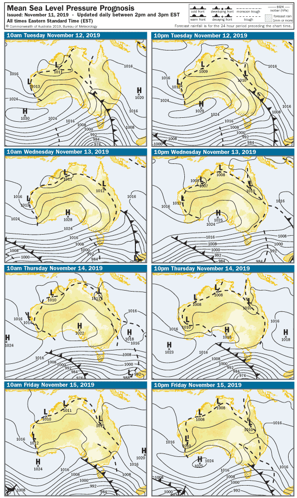
The 4 days synpotic reveals yet another series of cold fronts set to roll across the Great Australian Bight over the next few days, and they’ll bring strong W-SW winds on Tuesday, and maintain moderate W-SW winds until Saturday at least. The Mid Coast is flat tonight ( Monday ) with 12 knot WSW winds, and Middleton is bumpy with SW winds and surf only around 1′.
Tuesday morning will be cooler with fresh SSW winds early. The Mid Coast will have choppy 1 – 2′ surf early, but after lunch as the wind swings SW the swell and chop will get bigger. Seaford and South Port will be messy but probably in the 3′ late arvo with 27 knot SW winds. The swell should also build all day on the South Coast, but it’ll be messy at 3 – 4′ on the Middleton side as the sun sets.
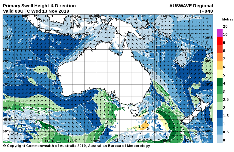
15 knot SW winds will settle in for Wednesday, and the Mid Coast’s semi stormy will ease to around 1 – 2′ after lunch. The South Coast will benefit from a more SW swell direction with surf up to 5′ at Middleton, but exposed breaks will be messy. West facing breaks over at Yorkes will be wind affected for most of the week, but a few part-sheltered spots will be worth a look.
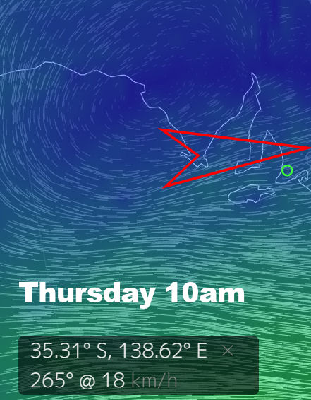
The swell looks pretty solid for the South Coast on Thursday, with a good Southerly vector. Winds will be westerly at around 15 knots all day, so it’s definitely worth checking part sheltered breaks like the quick chook. Ye olde Dump could be fun as well, part-sheltered, clean, and possibly in the shoulder high range. The Mid Coast will be back to around 1′ and choppy.
Another SW swell should lift wave heights on Friday, the Mid Coast will be 1 – 2′ and bumpy early with WSW winds in the 12 – 17 knot range. The swell should lift after lunch, but quality will remain wind affected. Down SOuth Middleton should be 3 – 4′ in the morning, building to 5′ later.
The wind will ease heading into the weekend, and may even go light SE early on Saturday. Swell will start to ease on the South Coast with surf around 4 – 5′ at Middleton affected by light onshore winds. The Mid Coast may be clean early with a fading swell and 1 – 2′ waves.
Sunday may also score light East winds in the morning, and the Mid Coast may have a few leftover 1 – 2′ waves. The South Coast will probably be lumpy with the dreaded East in the wind, but there’s a good chance it’ll be glassy early in the morning. It should also be a decent size, with waves in the 4′ range at Middleton. West facing breaks over at Yorkes should get a look in over the weekend – light winds should offer clean conditions both mornings and there will definitely be enough swell.
There’s another front linig up early next week, but let’s see how that pans out. For this week there’s no shortage of swell, and plenty of options for part-sheltered breaks to score some fun waves. Grab it while you can… sou-easters may arrive late this year, but they will certainly come and trash the party.