Nov 1 update
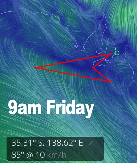
Just a minor update because the outlook has changed a bit heading into the weekend. The change should roll through SA today, but it’s weakening and we won’t see very strong winds behind it ( e.g. no stormy ).
In fact winds on Saturday look like they’ll be light and variable after shifting W-SW later today ( Friday ). The wind will probably be more NW early and then drop out after lunch, and there should be some new WSW swell as well. It would be a good day for a trip to Yorkes.
Winds will be offshore on the South Coast for a lot of the weekend, swell will be a bit bigger on Sunday but the wind will tend W-SW from late morning onward. Middleton should pick up to around 2′ on Saturday, maybe a bit bigger after lunch with light offshore NW winds and clean conditions.
The Mid Coast should have waves all weekend as well, you’ll just have to keep an eye on the wind. It will get a bit bumpy on Sunday but surf should be around 2′ – maybe bigger later in the day.
Oct 27
Last week’s forecast panned out pretty much as expected, even holding up pretty well as the weekend wraps up. Tonight there are bumpy 2′ waves on the Mid Coast with onshore WSW winds around 10 knots, and an easing swell down South is back to around 2′ at Middleton this evening with onshore winds adding some bumps.
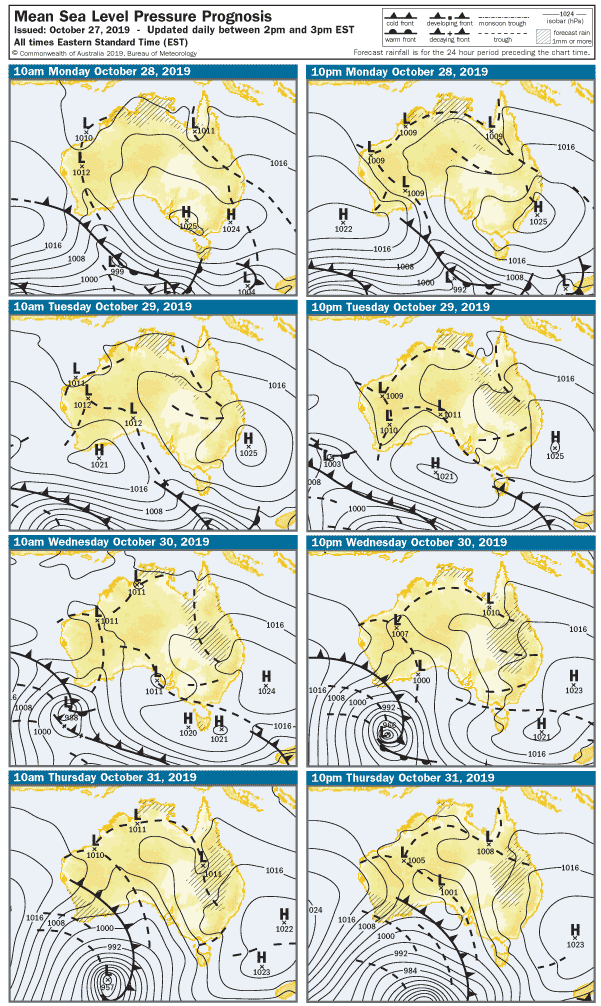
We’ll slip back into a springy weather pattern for the next couple of days, before Northerlies pick up ahead of a front due later in the week.
ENE winds will be light early Monday and the Mid Coast will be clean with waves around 1′. A new WSW swell will lift heights on the incoming tide after lunch to around 1 – 2′. Winds look good all day, remaining light and variable. The swell direction won’t be so good on the South Coast, with 1- 2′ waves at Middleton.
The breeze will remain light on Tuesday, but should have a bit of North in it. The Mid Coast should still have a few clean 1- 2′ waves in the morning and conditions should improve one the South oast after lunch with 10 knot NW winds. West facing breaks over at Yorkes will be good early Monday and Tuesday.
Temperatures will rise into the 30’s on Wednesday as winds tend more Northerly, and a WSW swell gets mostly wasted. The South Coast should remain in the 2′ Middleton range, probably a bit blown out as the wind picks up. The NW winds will add bumps on the Mid Coast, but there should be some 2′ waves.
Northerlies will rul on Thursday too, in the 20 – 25 knot range and shifting N-NW later. The swell direction will be about the same, so Middleton probably isn’t going to get much bigger than 2′. It’ll be 1 – 2′ and bumpy on the Mid Coast. Over at Yorkes, South facing breaks in Innes NP will be your best bet – breaks on the west side from Pondie to Berry Bay will be wind affected.
Friday is a bit of an interesting one.
The weather heading into the weekend will be dictated by a deep low traversing well south of SA. The low sets up a very complex series of Troughs, and at this stage, it looks like Friday will dawn to light East winds. That will coincide with a good WSW swell and a good chance of 2′ waves on the Mid Coast. if you were planning on calling the boss from Port Wakefield with a croaky voice saying that you “won’t be in today”, Friday is your day. Suffice to say west-facing breaks at Yorkes loom great all day, with winds going light SE after lunch. As we head into next weekend, it looks like playing out in a similar fashion with a change late Friday night and fresh onshore SW winds on Saturday.
The Mid Coast should develop a 3′ stormy much like last Saturday with 25knot+ SW winds. The swell should build on the South Coast during the day from 3′ at Middleton to bigger by late arvo. Winds will be cross-onshore at 25 knots, so it’ll be bumpy.
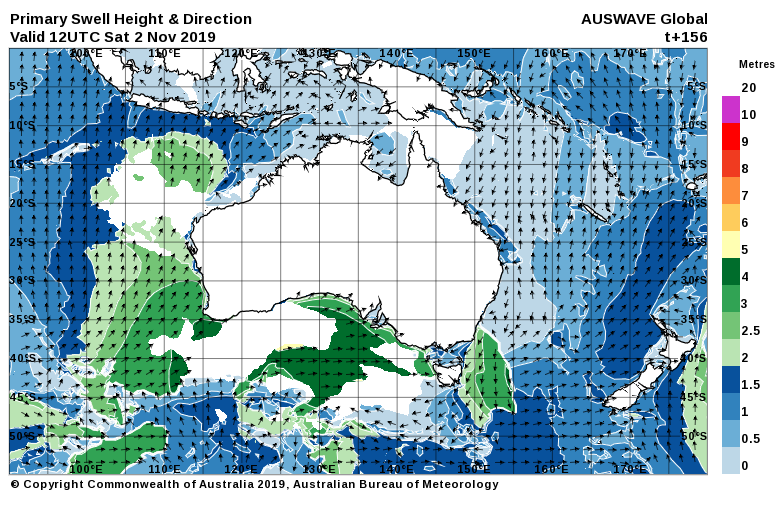
The wind and seas should moderate on Sunday, and with a strong Westerly swell, it’ll be worth keeping an eye on the Mid Coast late arvo.
A new WSW swell will build on Monday – more on that in the next forecast.