SA surf outlook Oct 8

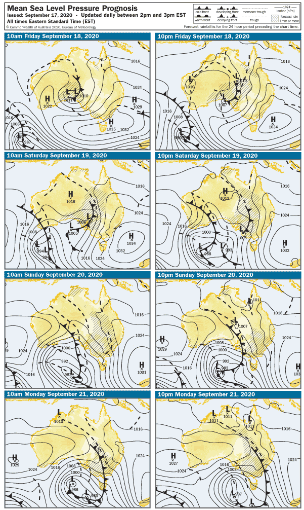
You might have noticed, it’s been slightly damp lately? As Australia stares down the barrel of developing La Niña weather pattern it’s probably to be expected… but October 2020 is looking like a record-breaker. The first week has already broken all prior record rainfall for the month, but we might even give the 1980 record of 105mm a scare if this keeps up.  So you might wonder… what does this mean for surf?

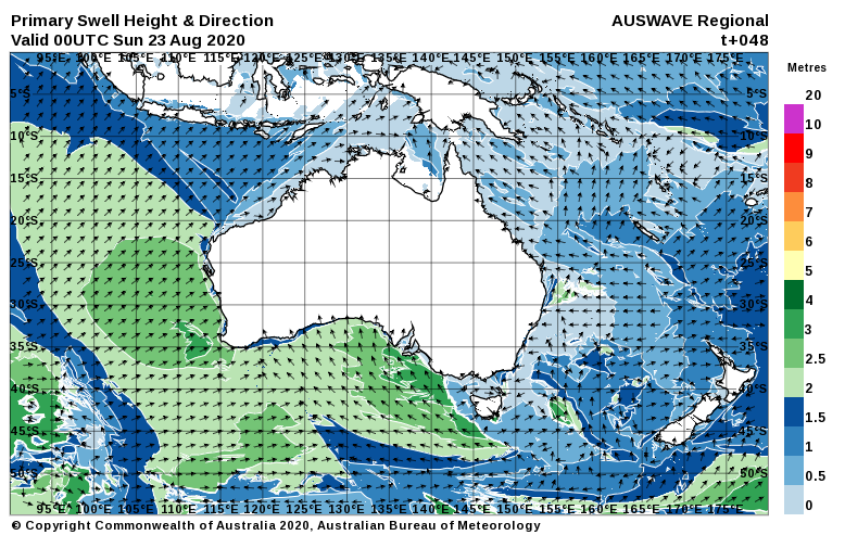
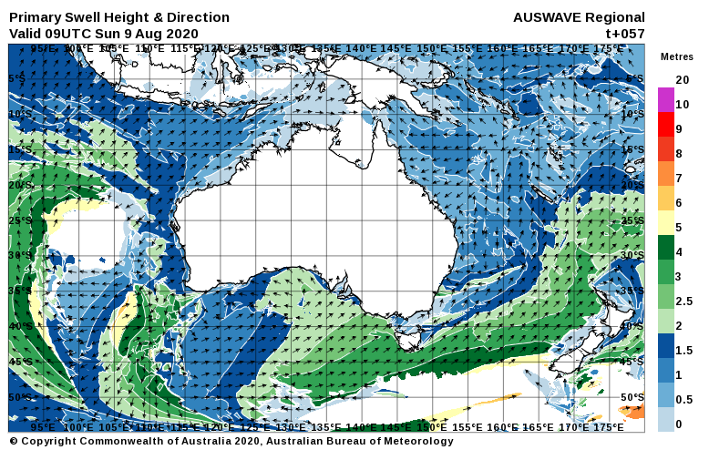
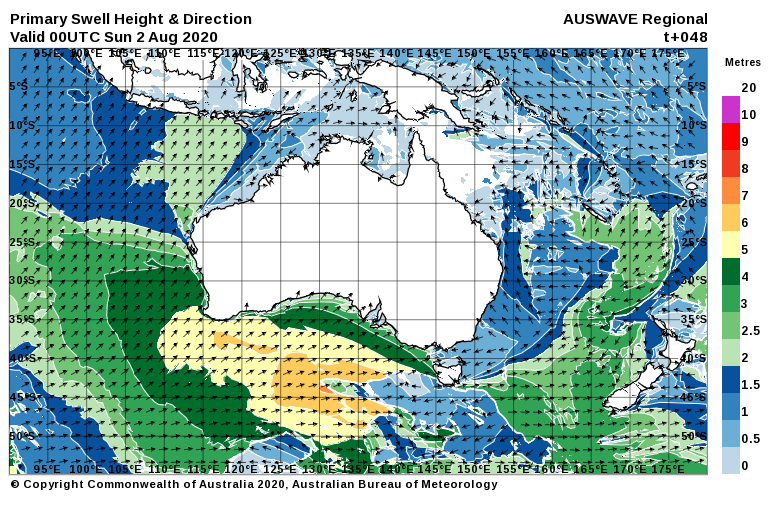
I’ve said it before and I’ll say it again… west-facing Southoz coasts are always good in the year a La Niña forms. The trade-off is that they are crap the year ( or two ) after. That certainly seems to have been the case so far, with a fabulous run of clean swell and good waves over at Yorks and that other peninsula – in just the first 8 days of the month. Heck, even the Mid Coast has had more surfable days than not, kicking off with an absolute thumper of a swell on Thursday the 1st.

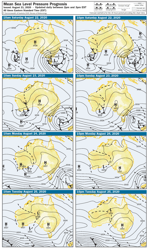
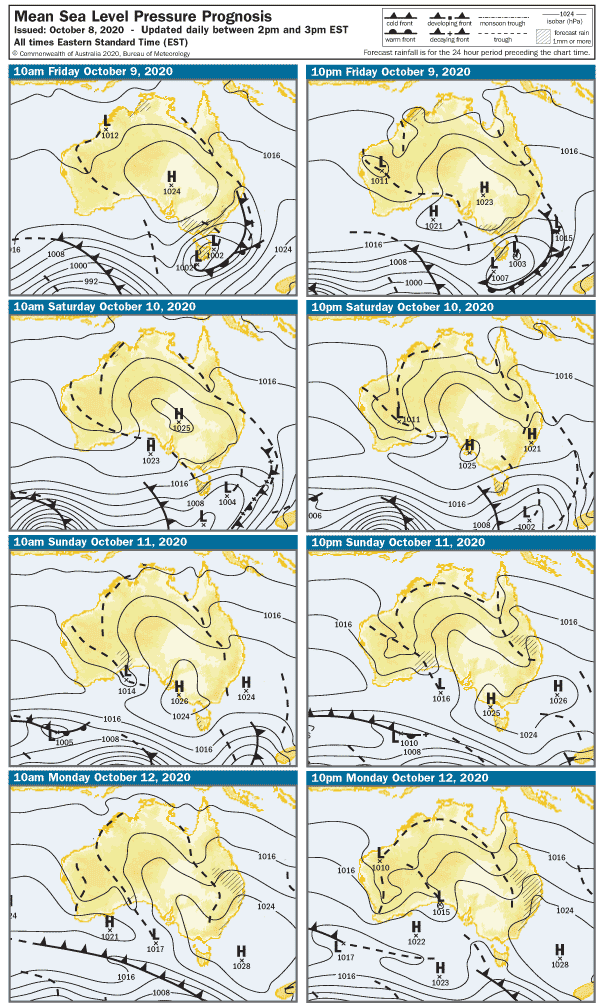
The next forecast period looks alright as well.

The stormy will be in its death throes on Friday, and the wind will be back to 10 – 12 knots from the West.  The Mid Coast will be bumpy with the onshore wind and around 2′ in the morning, but a new WSW swell might deliver a few bigger sets on the incoming tide later in the day. The light – moderate cross-shore wind will be OK for Middleton Bay / Point and the part-sheltered Waits Point, and surf should be around 3 – 4′ at Middleton.

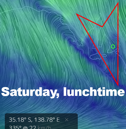
The weekend looks pretty good for the South Coast.

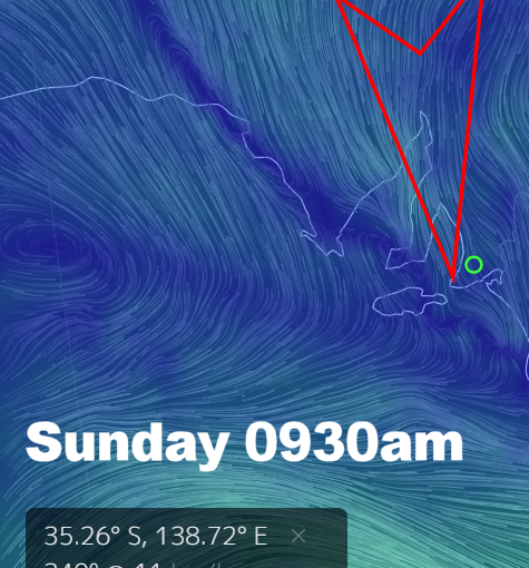
It’ll be semi-clean from Waits to Goolwa early on Saturday with a light NW wind tending Westerly at 12 knots after lunch.  Surf should be in the 3′ range at Middleton. The Mid Coast will also have some WSW swell but the West in the breeze will probably add a few lumps to waves around 2′.

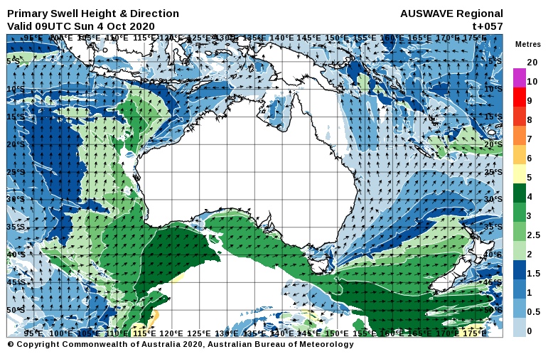
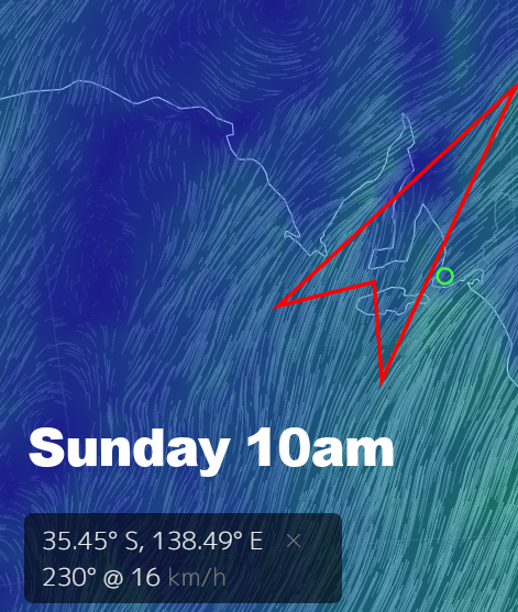
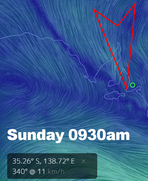
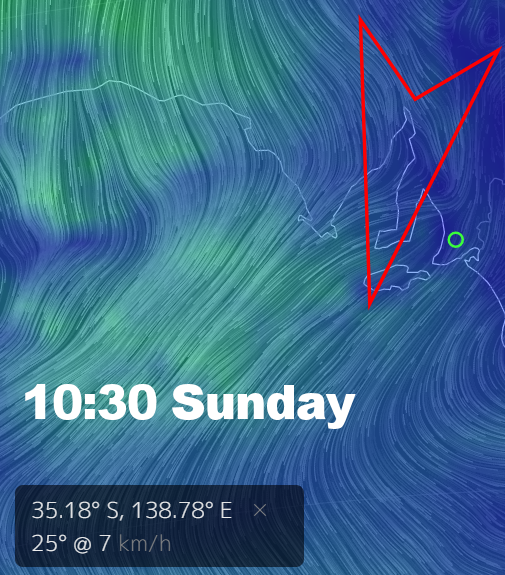
The breeze will have more East in it on Sunday, and that may add few lumps on the South Coast early.  The good news is winds will go light and variable after 11am and stay that way all day – possibly creating glassy conditions over the Mid Coast and Yorkes. Speaking of which, it’s not a few days to head over. Middleton will be smaller than Saturday but should have clean 2’+ waves in the morning, easing after lunch.  The Mid Coast will be 1 – 2′ in the morning, but there may be a minor pulse on the incoming tide.

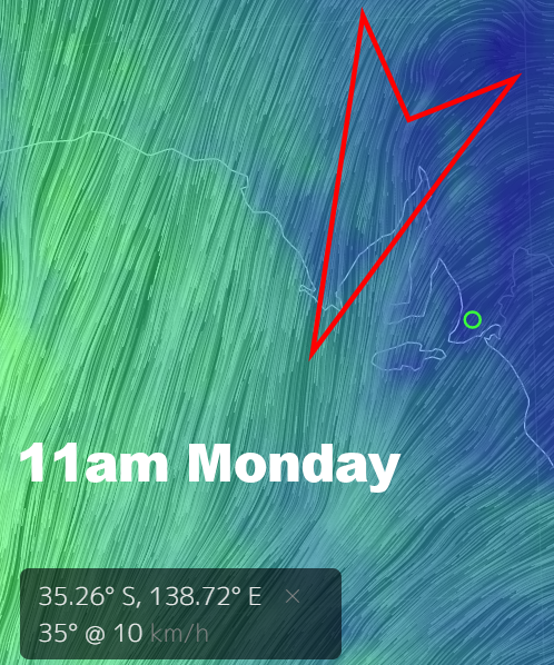
Back-to-school week will see more East in the wind, offshore and clean on the Mid Coast with surf holding around 1 – 2′ on Monday. Quiet west facing breaks at Yorkes FTW. The East in the wind will bring some sprig lumps to the South Coast, Middleton should be around 2 – 3′, Parson’s will be bigger and better suited to the wind.

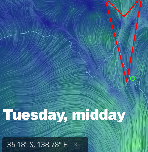
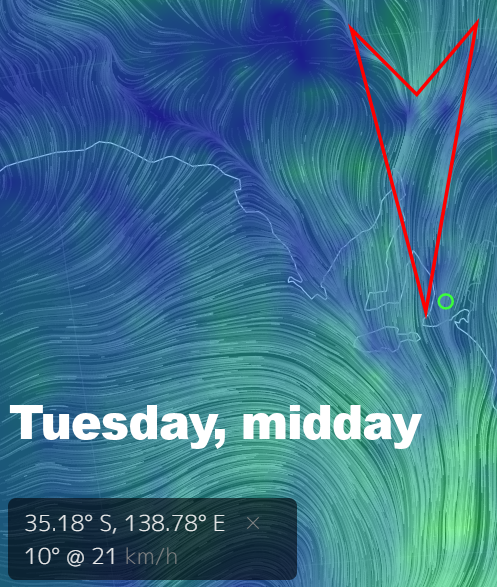
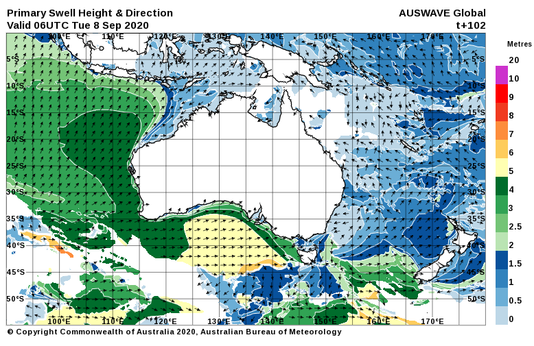
Tuesday looks better on the South Coast with a 2 – 5 knot North wind shifting NW and picking up to maybe 10 knots late morning. Middleton should be back up to around 3 – 4′, but the Mid Coast should also manage a few 2′ sets when teh tide co-operates. The wind won’t be perfect but it won’t make too much of a mess, hopefully. There’ll be no shortage of options in the Innes N.P.

A trough will turn winds to the SE overnight and on Wednesday it’ll probably be 10 – 15 knots. The Mid Coast will be clean but wave heights will beback to one foot or so. Middleton will also have an in-between day, with lumpy surf around 2′.

The wind looks more Easterly on Thursday at this stage, but that could all change by early next week. There’s still plenty of options over the next few days. Enjoy these pre- La Niña days and weeks… because the year after is sure to suck.

0

SA surf outlook Oct 2

Last week’s forecast went a bit off the rails toward the end of the period, but you’d have to say, if it had to happen it happened in a good way. October has so far produced two great days of surf across most of Southoz, including a surprisingly solid swell on the Mid Coast  Friday arvo.  As a bonus, the Northerly that had maintained some bumps all day finally gave up at 4pm, glassing off the gulf a treat, delivering glassy head-high sets to most of the reefs. So the billion-dollar question as we head into the first long weekend in yonks is, will this run continue?

A trough is heading in from the west and it’ll probably arrive on Saturday night. Ahead of it, winds will be from the North and probably 15 knots on the Mid Coast. There’ll be swell and a few 2′ waves, but South looks better tomorrow. The swell is clean and perfectly lined up from Goolwa to Parson’s this evening, and tomorrow looks about the same. The offshore won’t be too strong either – just enough to keep it smooth, and waves should be in the 3′ range at Middleton.  The wind will start to drop after lunch, and there’s a good chance of a glass off at some stage. For the South Coast, Saturday is the pick of the period.

Sunday will dawn to a light Southerly breeze, probably under 5 knots but building to 20 knots after lunch.  The Mid Coat might be glassy for a while in the morning, but gradually it’ll become bumpy as the wind picks up. Surf should remain in the 2′ range. There’s a slim chance it’ll be glassy on the South Coast with surf up to 3 – 4′ at Middleton, but it won’t last. Fresh southerlies will settle in by mid-morning and trash it for the rest of the day.

A 7 – 10 knot Southerly looks like maintaining a few bumps on the Mid Coast early Monday, but the wind should swing more SE after lunch and may be up around 17 knots at times. Surf will remain in the 2′ range. The South Coast will be messy with the onshore wind, Middleton will have surf in the 3 – 4′ range.

Tuesday / Wednesday are probably a good window for a Yorkes trip. The wind will be Easterly early Tuesday, tending SE at 15 knots after lunch. West-facing breaks will be fun, and even the Mid Coast will probably still manage a few 1 – 2′ waves.  The South Coast will be lumpy and the swell will be bigger – closer to 4 – 5′ at Middleton. Some lesser-known spots west of Victor might be worth a gander.

The wind should be light on Wednesday, variable in the morning shifting SE at 5 – 7 knots after lunch. Surf will be smaller anywhere west-facing, the Mid Coast will be back to 1′ with rare bigger sets. Surf should be in the 3 – 4′ range at Middleton, and it may be glassy in the morning.

On Thursday the wind will probably be SE and in the 5 – 10 knot range, so the Mid Coast will be clean. There will be swell, but wave heights probably won’t get much over 1′. The swell will be more WSW in direction and surf at Middleton will most likely drop to 2′ or thereabouts. Cross-onshore winds will add lumps.

At this stage, Friday is looking like an in-between day with light / variable winds tending SE. Added to the mix is a new WSW swell due Friday / Saturday. That might all change between now and then, but there will be waves *somewhere* almost every day for the next week at least.

0

SA surf outlook Sep 25

Remember around about this time last week I was banging on about West Coast troughs and cut-off lows, and the weather was kinda nice and sunny? Fast-forward to today when Mid-North towns have experienced snow-covered main streets, and many parts of Southoz have struggled to reach maximum temperatures in the double digits. Even as I’m typing it’s just started raining again… and seems like it has been for days. The surf has been alright on the South Coast at least.

Depending on your viewpoint, we are past the worst of it, and as we head into the first weekend of the dreaded school holidays the weather is looking more pleasant.

Early Saturday still looks a bit sketchy with clearing skies and 10 – 15 knot winds from the SSW.  The onshore breeze will chop up the South Coast, and the Mid Coast will drift into “fading stormy” mode. Middleton looks sloppy with surf in the 3′ range, and the Mid Coast will be bumpy and weak with messy waves around 1 – 2′.

The breeze will swing ENE overnight and it’ll be very light early on Sunday morning.  There won’t be much swell left on the Mid Coast, maybe a few 1′ Mally waves on the reefs that can handle a big morning tide. Conditions should be glassy on the South Coast early but there will be some leftover lump in the swell. Surf should be 3 – 4′ at Middleton in the morning, easing after lunch. Yorkes will be glassy and west-facing breaks will be clean all day – albeit with fading swell.

The ENE wind will pick up on Monday morning, and the Mid Coast will be clean – but pretty much flat. The 15 knot cross-offshore wind will add some lumps along the South Coast, but a more Southerly swell direction should see surf in the 3 – 4′ range at Middleton.  There might be spots west of Victor worth checking with that swell and that wind.

On Tuesday we’ll finally get back to a Northerly air stream, and the South Coast will be clean in the morning. The breeze should be around 10 – 15 knots at dawn, but it will build during the morning to 22 knots by the looks. Surf should remain in the 3′ range at Middleton, and it’s probably the cleanest day in the forecast period on the South Coast. The Northerly will add bumps on the Mid Coast, but don’t worry…  it’ll be flat.

The wind will have more West in it on Wednesday, 10 – 15 knots early and building to 20 knots later. The cross-offshore wind will be OK down South, but the swell is looking small and Middleton will probably only have surf around 1′.  The Mid Coast will be flat and bumpy.

Thursday will dawn to a fresh WSW wind around 25 knots, and a building swell on the Mid Coast. It’ll be messy with surf around 2′, building a bit after lunch. The South Coast will be slightly wind effected and probably blown out anywhere exposed – but not big enough for anywhere sheltered to break. Middleton is looking in the 2′ range.

A SW change will create bumpy conditions over the Fleurieu and Yorke Peninsulas on Friday, but the Mid Coast might conjure a stormy similar to yesterday ( Thursday ).

It’s looking hit-miss for the long weekend at this stage, but given how unpredictable the weather is at the moment, you never know what might happen. I’ll have more on that next week, once the picture is clearer.

0

SA surf outlook Sep 17

First up, let me apologise for the unusually long time between forecasts… it’s been rather a hectic week at the office.  But I have something special for you this week.

Behold my Metnerd™ brethren and sistren… a cutoff low! In all its glory!

This bad boy is almost a textbook example, complete with a West coast trough, an upper-level trough, and an East coast trough developing early next week.  A “witches wind” has howled across the Fleurieu all day today, and the gusts from the ESE have been over 30 knots at times.  It’s blown what was left of the small Mid Coast swell over to Ardrossan, and the same strong Easterly has made a mess on the South Coast.  So you may well wonder… what does it all mean for surf over the next few days?

The South Coast absolutely pumped earlier this week, and your best shot for clean waves again at this stage looks like Sunday… but I’ll get to that in a tick.

That gully wind will howl all night tonight, and back off slightly on Friday morning. It’ll still be enough to keep the Mid Coast completely flat, and west facing coast over at Yorkes will be small and blown out as well. The wind overnight will leave the South Coast very messy, with 3 – 4′ lumpy conditions between Middleton and Goolwa. Parson’s Point will be nicely sheltered early Friday, and probably solid. Should be Easterly at 15 – 17 knots early Friday.

Saturday is looking a bit cray-cray. The weather is looking super unstable as the cut-off low takes effect, the East wind may gust over 30 knots again and it’s probably gonna come with rain and storms. You probably won’t be too worried about surfing anyway – the Mid Coast will again be blown flat by the tind, and the South Coast will be, well, diabolical. It’s a shame, because a new SW swell should lift Middleton from 3 – 4′ in the morning to 5′ or so by late arvo. It’s looking a lot like a roof rippin’, tree upending sorta day, so stay safe.

That long-awaited Northerly will finally arrive on Sunday, but it’ll gain strength not long after sunrise. Pre-dawn it should be around 10 – 15 knots, the South Coast will have plenty of leftover lumps to iron out but it should straighten up during the morning. There may be a few 4 – 5′ sets at Middleton, but the swell will have peaked and should ease after lunch. It’ll probably be blown out by 25 knot offshores by then. The Mid Coast will be bumpy from the Northerlies, and flat again. South Coast breaks over at Yorkes will be the best option, but they’re looking pretty big on Sunday – 6′ or more.

The working week will open to a gusty Nor-wester, probably 35 knots Monday morning shifting stong Westerly after lunch ahead of a gusty change in the evening. Surf will probably be back to 2′ at Middleton and it’ll be blown to bits between Dribs Point and Goolwatu.  The Mid Coast will have chopped up 1′ waves in the morning, but a new WSW swell should lift it to 3′ by evening. I can think of somewhere three hours away that might like that scenario.

The front will roll through Monday night and the wind will go ’round to a strong Westerly early on Tuesday. The Mid should produce a building stormy that will run on into Wednesday, when the wind will swing more WSW at 27 knots. It’s hard to say if sheltered spots in the gulf and metro beaches will have surf, but it’s a possibility Tuesday arvo / Wednesday morning. A big SSW swell will also pound the South Coast, and the Middleton – Goolwa stretch will probably in the 6′ range. Sheltered spots will be worth a look on Wednesday, and ye olde Dumpe will definitely have something. Conditions will start to moderate later on Wednesday.

Thursday looks like it’ll dawn to a SW wind in the 15 knot range,  and a solid SSW swell should keep wave heights on the South Coast in the 6’+ range. With easing  SW winds, there might be some interesting options – especially sheltered ones. The swell will fade on the Mid Coast, and with the onshore wind it’s looking like choppy 1′ surf is all that’ll be on offer.

Gazing deeper into the crystal ball, a new WSW swell is lining up around Friday-ish, but there’s some whacky weather to get past first. Let’s see how that looks next week.

0

SA surf outlook Sep 4

Spring had finally sprung and Southoz has signed off on a hit-miss sorta end to August, but will the first week of September spawn a monster? Let’s take a look at the charts, because they are still interesting.

A large HIGH is cruising into Southoz this evening,  and that’s why the wind has dropped this afternoon. Early on Saturday the breeze will shift to the  WNW, probably around 5 knots in the morning. The Mid Coast will be on the lumpy side but there should be a few 2′ waves with a high tide around 6am.  The cross-shore winds will mean the South Coast is fairly clean all day, probably better in the morning with WNW winds shifting WSW at 7 knots later. Middleton should be in the 3 – 4′ range, so The Bay / Point will be alright on Saturday.

Alight Nor-easter will kick in early Sunday, and the South Coast should be nice and clean all day. The swell will wind back a bit but Middleton should remain in the 2 – 3′ range, with more size around at Waits and Parson’s. The wind probably won’t get much over 10- 15 knots after lunch, and it’ll stay offshore all day. The Mid Coast might have some cleanish waves early on Sunday, around 1 – 2′ but dropping out with the tide during the morning. Father’s day is the pick of the next week for the South Coast, so call in that favour for Sunday morning pops.

A fresh Northerly will arrive for the start of the working week,  the Mid Coast will be bumpy and probably back to 1′ or so… plus 1′ of wind swell early on Monday.  There might be an early window on the South Coast, but strong offshore North winds look like blowing it out by mid-morning.  Surf will be around 1 – 2′ at Middleton.

A trough will move through SA Monday night, and early Tuesday the winds should be around to the South and light.  There’ll be leftover bumps on the Mid Coast, but there should be a few 2′ waves in the morning. The swell looks like it’ll build on the incoming tide after lunch, but light South winds will add some lumpiness. It’ll be light onshore and bumpy on the South Coast all day, surf will be around 2 – 3′ at Middleton in the morning, but possibly bigger by late arvo.

After Tuesday we’ll go into a more springy weather pattern again, with ESE winds early on Wednesday tending SE at 15 knots after lunch. There should be some clean 2′ waves on the Mid Coast when the tide plays nicely, Middleton should be around 3′ but the wind will add lumps to the swell. Wednesday – Friday is the pick of it for an early spring Yorkes trip.

The wind will be out of the East at around 10 knots all day on Thursday, the Mid Coast will be clean and a nice WSW swell should maintain surf in the 1 – 2′ range all day.  The Easterly will add lumps on the South Coast, Middleton should be around 2′ but Parson’s will be cleaner and a foot bigger.

The wind will swing NE on Friday by the looks, and most of the Fleurieu will have small waves around 1′. Ths Mid Coast should lift later with a new swell… but more on that next week.

0

SA surf outlook Aug 28

After strolling along pretty much any stretch of South Australian Esplanade this afternoon, very few people could blame for sticking a fork in winter’s arse and announcing, merrily, “it’s done!”. As I type this there’s almost no wind across the entire state, and the sea is glassy smooth over every peninsula SA has ( yes… even the Dudley and the Jussieu! ). There’s swell too… and today was very nice… but as we head into the last weekend of August things are about to turn.

Early on Saturday the wind will start to pick up from the North, tending NE at first and maybe under 10 knots… but probably not for long. A 20 knot Northerly looks like settling in from about mid-morning onward. The Mid Coast should have a few 2′ waves early, but as the wind arrives it’ll become bumpy quickly.  The South Coast will be clean and there will be waves in the 4 – 5′ range at Middleton. It’s definitely worth a trip, but only if you can hit it at dawn. Most of the South Coast will be probably be blown out by morning smoko.

The wind will have more West in it early on Sunday off the back of a cold front that will roll through overnight. WNW winds will be up around 25 knots in the morning, tending more WSW at 27 knots after lunch. The solid swell should stui=ick around on the South Coast, but options will be limited to sheltered / part-sheltered sports. Middleton Bay might be OK. The Mid Coast will go into semi-stormy mode, and waves should get up around 3′ after lunch – but it’ll be messy with fresh onshore winds.

The wind and weather should quickly moderate overnight, and into the start of the working week we could well be back to light / variable winds. The breeze will be more southerly on Monday so the South Coast will probably be light onshore, bit if there’s some East in the breeze the Mid Coast might be glassy with some leftover lumps. Middleton should still be in the 4′ range and wind affected, the Mid Coast might see a few 2 – 3′ waves before the swell eases from mid-morning onward.

Tuesday will open with winds from the North, up around 22 knots at dawn and strengthening ahead of another cold front.  The Mid Coast will be bumpy with surf around 1 – 2′, and a more WSW swell will mean less size on the SOuth Coast – maybe 2 – 3′ Middleton. The South Coast will be blown out from dawn to dusk, and by late more NW winds will probably be gusting over 27 knots.

Wednesday will be windy and messy, with WNW winds at 30 knots settling in for the day.  Wave heights will pick up on the Mid Coast, and there’s a chance stormy spots might come into play after lunch. The South Coast should also score a building SW swell, with 3′ waves at Middleton building to 5′ or s after lunch. It’ll be blown out all day by the strong west winds.

The strong westerlies will continue into Thursday, and so too will the stormy waves on the Mid Coast. Surf will remain in the 3′ range, and again, stormy venues might be worth a squizz. The swell direction looks too West to really light up South Coast breaks, and Middleton will probably remain in the 2 – 3′ range… possibly smaller if the swell maintains the direction the models are suggesting.

The weeks should wrap up with a fresh sou-wester on Friday, and easing conditions heading into the weekend. The Mid Coast will probably remain messy with surf in the 2′ range. Size is hard to call that far out on the South Coast, but probably somewhere between 2 – 4′. Conditions should ease with lighter winds into Saturday. More on that next week…


0

SA surf outlook Aug 21 ( weekend )

Just a quick update covering the weekend, because I am actually still at work. Oh the joys of a 9 to 5 job… or should I say a 9 – midnight job. 😀

Winter is having what might be a final blast this weekend, and it’s gonna be wild and woolly across the entire state.

A big SW swell is slamming the South Coast this evening with sets in the 6’+ range at Middleton. The wind is still strong from the WSW so it’s really messy – but sheltered spots will be worth a look early Saturday. Possibly even some novelty spots along the South Coast will get a look in. The wind will be 20 – 30 knots from the SW, and wave heights may well get up around 6 – 8′ between Victor and Port Elliot. The Mid Coast will be similar to Friday, possibly bigger after lunch with choppy 2 – 3′ surf and 30 knot onshores.

Early Sunday the wind should ease off, and late morning it’s definitely worth checking a few sneaky spots along the South Coast. The swell will probably peak in the early hours of the morning, so it’s still looking in the 6 – 8′ range up until lunchtime at least.  The swell is almost SSE in direction, so it’ll be one of the largest of winter 2020.

The Mid Coast will remain messy and onshore, SW winds should ease to maybe 15 knots by late arvo, surf will be in the 2′ range. Conditions will moderate into the start of the week, with SW winds at 10 knots early Monday morning, and messy 2; waves on the Mid Coast. The South Coast will have a fading swell, still 4 – 6′ surf early easing back to 3 – 5′ later.

I’ll update the outlook for the rest of the week in a couple of days.

0

SA surf outlook Aug 14

Last week’s forecast turned out to be not far off the money, except for Friday which was a long shot. As we head into the weekend, light winds look set to continue as a large HIGH pressure system moves over Adelaide. So what about swell? That’s a good question…

The wind will be light over the next two days and out of the West, trending more Northerly after lunch on Sunday. The swell looks like it’ll have more West in it than South, but the South Coast should still have something surfable on both days.

On Saturday, winds will be around 5 – 7 knots from the WSW, swinging more to the SW after lunch and picking up 12 – 15 knots.  The light-moderate onshore wind will keep the Mid Coast bumpy all day, surf should be in the 1 – 2′ range and not very spectacular. It’ll be cross-shore on the South Coast in the morning, but more onshore after lunch with SW winds. Surf is looking in the 1 – 2′ range at Middleton.

The breeze will be light from the west early on Sunday, the Mid Coast will probably be wobbly with the light onshore, but some 1 – 2′ waves should persist thanks to a WSW swell direction. The swell direction won’t be so great down South, but the wind may be light NW after 2pm so it should be clean. Waves are looking in the 1 – 2′ range at Middleton for most of Sunday, Waits will be slightly bigger on the sets.

SA goes into pre-frontal mode for the start of the week, and the wind will be fresh from the North early on Monday.  The Mid Coast will be bumpy and surf will only be around 1′, but it’ll build during the day with a westerly change / cold front mid arvo.  The South Coast will probably be blown out along exposed stretches, and the less-than-ideal swell direction will cap wave heights again to around 2′ at Middleton.

Tuesday morning will probably open to WNW winds around 15 knots, picking to 20  -15 knots during the day. The Mid Coast will remain bumpy, with surf around 1′ early building to 2′ after lunch.  The South Coast’s run of small waves will continue, with Middleton not much over 1′ and blown out.

A more intense cold front should arrive after lunch on Wednesday, probably bringing a stormy to the Mid Coast. NW winds may be over 30 knots not long after sunrise, and as the front moves through, gale-force West winds look like hammering any west-facing coast. The wind and swell will still be not great on the South Coast, but the swell should build from 1′ early to maybe 2 – 3′ later. The wind should also push messy 3′ surf into Mid Coast beaches. Partly-sheltered spots may be worth a check late arvo.

The front will roll through overnight and conditions should moderate after lunch on Thursday. The wind will be fresh from the SW in the morning, the Mid Coast should have leftover 2 – 3′ stormy waves, easing after lunch.  The South Coast will be blown out, maybe 2 – 3′ at Middleton due to a very Westerly swell.

Conditions will moderate toward the end of the week, but at this stage Friday still looks like it’ll suffer SW-S winds and fading swell. That could all change by next week, of course…

0

SA surf outlook Aug 7

We really did see the dream end on the South Coast this week, hey?

July seems like a distant memory with its seemingly endless run of offshore winds and fine weather on the South Coast, but the first week of August feels more like a climactic twilight zone.  It snowed in the Flinders Ranges today, and on Tuesday morning more than a few Southoz towns woke to temperatures 3 or 4 degrees below freezing. Meanwhile, the wind has been 15 knots from the East over the Fleurieu and Yorke peninsulas… as if we passed “Go”  and proceeded straight to the month of November. Weird.

That Easterly influence will persist into and through the weekend, and that’s not great views for the South Coast. A lack of west in the swell is also not great news for west-facing coastline, including the Mid Coast and breaks between Pondalowie and Berry Bay over at Yorkes.

Saturday looks set to kick off with 15 knots SE winds and messy 2 – 3′ surf at Middleton. A more SW swell direction might bring a few 1′ waves to the Mid Coast, and it’ll be clean with moderate offshore winds. West facing breaks over at Yorkes will be clean all day, and at least not flat.

The breeze will ease on Sunday morning but it’ll still be from the East – 7 knots in the morning. The lumpiness will persist on the South Coast which is a shame, because the swell will build overnight and lift wave heights to 3 – 4′ at Middleton. The Mid Coast will be clean, but only 1′ again.

The wind will finally have some North in it on Monday morning, but it’ll take a few hours to iron on the lumps on the South Coast. Surf should be around 3′ at Middleton, maybe cleaner after lunch after a few hours of NNE winds.  The Mid Coast looks small, with surf only around 0.5′.

Tuesday will dawn to fresh Northerly winds up around 22 – 25 knots not long after sunrise. It’ll be clean on the South Coast, but probably on the blown-out side along exposed stretches. Wave heights will ease back to 1 – 2′ at Middleton. The Mid Coast will be almost flat, and bumpy with the wind blowing chop down the gulf.

The wind should be more NW early on Wednesday,  17 knots and shifting more WNW after lunch. The swell will tend more WSW and it’ll probably lil=mit wave heights to around 1′ at Middleton.  A new swell should lift the Mid from 1′ in the morning to 1 – 2′ after lunch, so maybe check Moana for a late paddle.

A change is likely on Thursday, with West winds at 25 knots shifting W-SW after lunch. The Mid Coast will be choppy 1 – 2′ in the morning, possibly bigger after lunch with a medium-sized stormy.  It’ll be semi-clean on the South Coast but probably a bit blown out with strong cross-onshore winds and surf in the 2 – 3′ range at Middleton.

Friday looks like a fresh sou-wester, but let’s revisit that at the end of next week.

0

SA surf outlook Jul 31

**Late update… Sunday could turn onshore early on the South Coast – bigger on Sunday but better wind Saturday. **

So here we are…  at winter’s 66.66% mark, on a Friday night, marking the end of dry July. I say that advisedly because according to the Bureau of Meteorology, this year is the driest July on record in Adelaide. Ever. While that’s actually shitty news for all those trying to live off the land, it’s meant almost an entire month of offshore wind and clean conditions on the Fleurieu Peninsula’s South Coast for us incredibly self-centered surfers. As hard as it might be to fathom, the weekend is looking mostly the same.

The wind will be from the North and up early on Saturday, 10 – 15 knots on the Mid Coast and lighter down South early.  The Mid will be bumpy and waves will only be around 1′, South is looking bigger but not much bigger with a less-than-ideal swell direction. Middleton should be clean and around 1-  2′, Waits and Parson’s will be your best bet for shortboard waves.

The swell will lift overnight and early Sunday is a good call for a trip South. Winds will be NE at 5 knots early, shifting NE then WNW mid arvo, but remaining light all day.  Wave heights should lift from 2′ at Middleton to 2 – 3′ after lunch. The light cross-shore wind will be fine along the Middleton – Goolwa stretch after lunch, but it’ll be glassy in the morning. The Mid should also lift overnight, and will have 1′ waves with a few bigger sets on incoming tides.

A weak trough will swing winds to a light onshore Southerly early on Monday, the Mid Coast may be semi-clean early with 1 – 2′ waves.  Middleton will be wind affected all day, more so after lunch as the Southerly builds to around 12 knots. Surf will pick up as the swell tends more SW, with bumpy waves around 3 – 4′.

The Southerly will gain energy ahead of an incoming HIGH into Tuesday, probably 17 knots in the morning and tending more SW after lunch and backing off slightly. The onshores mean null points on the South Coast which is a shame, because it looks like the surf will build to 4 – 5′ along open beaches. The Mid Coast will be bumpy and probably only around 1′.

Wednesday should see the breeze back around to the East, but the Mid Coast will be lucky if it’s shin-high. At least it’ll be clean. The East in the breeze will add unwelcome lumps along the South Coast, spoiling what would have been 4′ waves along the Middleton / Surfer’s stretch.

The Easterly looks stronger on Thursday, possibly 15 knots in the morning. Again, it’s bad news for the South Coast, surf should be in the 3′ range at Middleton but there will be plenty of lumps in the swell. The Mid Coast will be clean, maybe 1′ in the morning, but a new WSW swell should lift size to 2′ after lunch – possibly even bigger on the sets.

Friday should be back to light / variable winds, but that’s a fair way off. Things can, and will change quickly at this time of year.  South Coast early Sunday may be the pick of the weekend, but you’ll get clean waves down there both days. Weather looks great too.

Get on it.

0